When you're looking to hire a drone photographer for a property, you can expect the cost to land somewhere between $150 and $500. This isn't just for a few snapshots from the sky; it's an investment in a powerful marketing tool that gives potential buyers a perspective they can't get from the ground. A great aerial shot can be the very thing that helps a listing sell faster.
A Snapshot of Drone Photography Costs
Before we get into the nitty-gritty of what drives these costs, it's helpful to get a baseline understanding. Think of drone services less like a single, fixed-price item and more like a menu of options. A quick set of aerial photos for a standard suburban home is going to have a very different price tag than a sweeping cinematic video of a luxury estate on the water.
The final price tag can vary quite a bit. Many seasoned pros charge between $150 and $500 per hour, a rate that accounts for their skill, expensive gear, and local market demand.
When you look at pre-packaged deals for real estate, a basic set of high-quality aerial photos (with standard editing) typically runs from $150 to $400. If you want to add video into the mix, those packages usually start around $200 and can go up to $500 or more.
Average Drone Photography Service Prices for Real Estate
To make these numbers more concrete, here's a breakdown of common service packages you’ll likely come across. This table outlines common market rates for real estate drone photography, helping agents budget effectively and photographers set competitive prices.
| Service Package | Typical Price Range Per Property | Ideal For |
|---|---|---|
| Core Aerial Photos | $175 - $350 | Standard residential listings needing key exterior shots of the property and lot. |
| Plus Photo & Video | $400 - $750 | Larger homes or properties with unique features that benefit from a short video clip. |
| Premium Cinematic | $750 - $1,500+ | Luxury estates, commercial properties, or listings where storytelling is crucial. |
This table gives you a solid starting point for matching a service to a property's specific marketing needs.
Remember, the goal isn't just to get some drone shots. It's to invest in a marketing asset that tells a compelling story about the property, its features, and its place in the neighborhood.
This pricing structure isn't just pulled out of thin air. It’s carefully built on the cost of professional equipment, federal licensing, liability insurance, and the considerable skill needed for both flying the drone and editing the final images. We explore these concepts in more detail in our comprehensive guide on how to price real estate photography.
Next, we'll dive into exactly what goes into these costs so you know what you're paying for.
Why an Aerial View Is a Listing's Superpower
Before we get into the nuts and bolts of real estate drone photography pricing, let’s talk about why this has become such a game-changer. It's easy to think of drone shots as just pretty pictures from the sky, but they do something far more important: they tell a story that ground-level photos can't. You’re building an emotional hook that stops a casual online browser dead in their tracks.
Think of it like this: a regular photo shows a nice backyard patio. A drone shot, however, shows that the patio overlooks a quiet lake, is just a short walk from a community park, and is surrounded by a sprawling, private yard. It instantly answers questions a buyer didn't even know they had about the property's size, its relationship to the neighbors, and its place in the community.
That's the magic. It’s not just about the house; it’s about the lifestyle that comes with it.
Turning Clicks into Showings
This isn't just a hunch; the data backs it up. Giving potential buyers a complete, transparent view from above can seriously speed up the sales process. They get a real feel for the property before they even book a visit, which means the people who do show up are far more serious.
For certain properties, drone shots are an absolute must. If you're listing a home with a large lot, a unique layout, or incredible surroundings, there's simply no better way to show off its best features.
- Lot Size and Shape: You can clearly see the property lines and how much usable space there is.
- Proximity to Amenities: Is it close to a great school, a park, or the waterfront? A drone shot proves it.
- Roof and Property Condition: It offers a transparent, bird's-eye view of the home's overall upkeep.
- Neighborhood Vibe: You can capture the character of the street and the surrounding area in a single frame.
This all-encompassing view helps buyers picture themselves living there, which is what gets them to pick up the phone. It elevates a property from just another listing in a sea of thumbnails to a place they have to see in person.
A ground-level photo shows a house. An aerial photo sells a home. It frames the property as part of a larger, desirable world, making the value proposition instantly clear to potential buyers.
The market data tells the same story. According to 2023 figures from the National Association of Realtors (NAR), listings with aerial photos sell an incredible 68 percent faster than listings that stick to ground-level shots. That’s not a small difference. It’s why drone photography has gone from a nice-to-have luxury to a core part of any competitive agent's marketing toolkit. You can dig deeper into these real estate photography trends and see the impact for yourself.
The Financial and Emotional Payoff
At the end of the day, investing in professional drone photography is about making a property as appealing as possible to get it sold faster and for a better price. The upfront cost is almost always a drop in the bucket compared to the return, whether that’s a higher final offer or the savings from slashing days on market.
By creating a captivating and honest first impression, you make your listing stand out. It’s a superpower that doesn’t just get more views—it gets the right views from serious, well-informed buyers ready to make a move.
Deconstructing The Costs Behind The Camera
When a real estate agent gets a quote for drone photography, it's natural to look straight at the bottom line. But that number represents so much more than just an hour of flight time. You're actually investing in a whole ecosystem of professional skill, high-end technology, and critical operational costs needed to produce those stunning, legally-compliant aerial shots.
Getting a handle on these underlying expenses is key. For agents, it highlights the true value of the service. For photographers, it builds the confidence to charge what you're worth. Let's pull back the curtain and see what really goes into real estate drone photography pricing.
What a Professional Drone Photographer's Price Includes
When you hire a pro, you're not just paying for their time on-site. The price tag covers a wide range of essential business costs that ensure quality, safety, and legality. This table breaks down what's really baked into that final quote.
| Cost Component | Impact on Service and Price | Typical Investment |
|---|---|---|
| Commercial Drone | Provides stable, high-resolution images and video crucial for professional results. | $2,000 - $5,000+ |
| FAA Part 107 License | Ensures the pilot is legally certified to fly commercially, avoiding huge fines. | $175 exam fee + study costs |
| Liability Insurance | Protects the agent, client, and property from accidents. Non-negotiable. | $700 - $1,200 annually |
| Editing Software | Professional software like Adobe Creative Suite is needed to process photos and video. | $600+ annually |
| High-Performance Computer | Required to handle large 4K video files and high-resolution RAW photos efficiently. | $2,500 - $4,000+ |
| Batteries & Accessories | Multiple batteries are needed for uninterrupted shoots on larger properties. | $500 - $1,000+ |
| Ongoing Training | Staying current on FAA rules and new photography techniques requires continuous education. | $200 - $500+ annually |
As you can see, the overhead for a legitimate drone photography business is substantial before the photographer ever even steps on a property.
The High-Tech Toolkit
The most obvious expense is the gear, and it's a lot more than just the drone itself. A pro-level setup is a serious investment built for one purpose: delivering exceptional, reliable results. A good commercial drone for real estate can easily run $2,000 to $5,000, sometimes more. These aren't hobbyist toys; they have better cameras, superior wind resistance, and critical safety systems.
But the shopping list doesn't end there. A professional's flight bag is packed with essentials:
- Multiple Batteries: One battery gives you maybe 30-45 minutes of flight. To cover a big property or do back-to-back jobs, a photographer needs a whole stack of them, which adds up to hundreds of dollars.
- High-End Cameras & Lenses: Even on drones with integrated cameras, the systems are incredibly advanced, with large sensors that perform better in tricky lighting and capture more detail.
- Specialized Software: Polishing those images and videos requires powerful editing suites like Adobe Lightroom, Photoshop, and Premiere Pro, which all come with pricey yearly subscriptions.
- A Beast of a Computer: Editing 4K video and massive RAW photo files will bring a normal computer to its knees. A powerful workstation capable of handling the workload is another multi-thousand-dollar necessity.
This infographic shows exactly how that investment in a bird's-eye view pays off by driving faster sales and attracting more serious buyers.
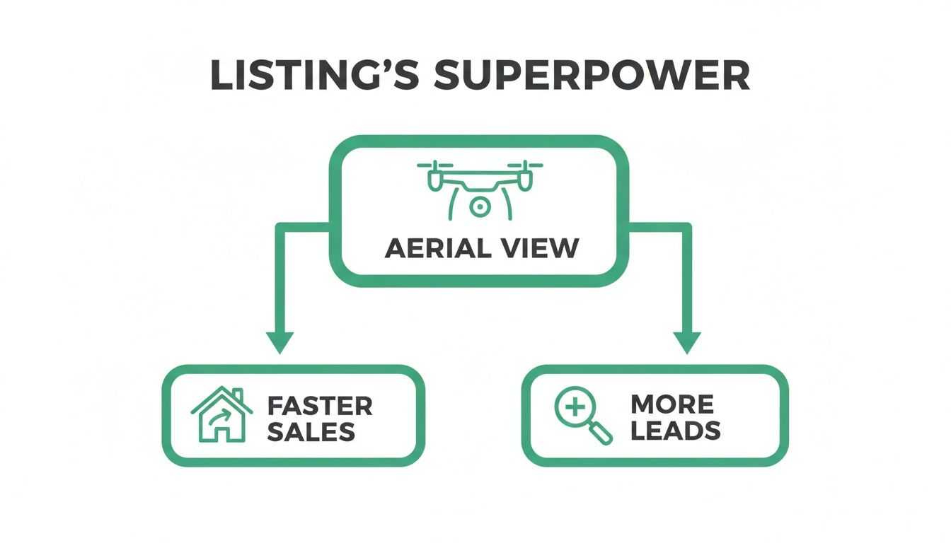
It's a clear line from professional aerial content to the two biggest goals in real estate marketing.
The Invisible Costs That Protect Everyone
Beyond the gear you can see, a huge chunk of the cost comes from "invisible" expenses that are absolutely vital for a legal, safe, and professional operation. These are the non-negotiables that separate the pros from the amateurs.
First up is the FAA Part 107 Certification. Anyone flying a drone for business—and that includes all real estate photography—is required by law to have this license. Getting it means passing a tough aeronautical knowledge test and completing recurrent training every two years to stay sharp on all the rules of the sky.
Hiring an unlicensed pilot isn’t just a bad idea—it’s illegal. If an accident happens, it puts the agent, the brokerage, and the homeowner at risk of serious legal and financial trouble.
Right alongside that is liability insurance. Any professional pilot will carry a policy, often for $1 million or more, to cover potential damages or injuries. This is your safety net, and it's a clear sign you're working with a responsible business owner. The annual premiums for this kind of specialized coverage are a major operational expense.
The Value of Time and Expertise
Finally, and maybe most importantly, you're paying for the photographer's skill and time. This goes way beyond the hour they spend on-site. For every hour of flying, there are often several more hours of work happening behind the scenes.
- Pre-Flight Planning: This is mission control. The pilot checks airspace maps for restrictions (like being near an airport), monitors weather forecasts, scopes out potential hazards on-site, and collaborates with the agent on a shot list.
- On-Site Flight Time: This is the actual execution of the flight plan, capturing all the planned photos and video clips.
- Post-Production: This is where the raw materials become a polished marketing tool. It means sorting through hundreds of photos, color grading, sharpening, editing video, adding music and graphics, and exporting the final files. This editing process alone can easily take 2-4 hours for a typical property.
When you hire a professional drone photographer, you're getting the full package: their gear, their legal compliance, their insurance coverage, and their artistic eye to turn raw footage into something that helps sell a home. To dig deeper into the technology, check out our guide on the best drones for real estate photography.
Structuring Your Drone Photography Packages
Knowing the costs is one thing, but knowing how to buy or sell drone services is where the real strategy kicks in. For real estate agents, the right package can make a listing unforgettable without blowing the budget. For photographers, well-built packages are the foundation of a clear, profitable, and scalable business.
The idea is to get away from one-off custom quotes for every standard job. Instead, you want to create a transparent menu of options. This approach makes booking simple and sets clear expectations from the get-go, making the whole experience feel professional and smooth for everyone.
Choosing Your Pricing Model
When it comes to real estate drone photography pricing, you’ll mostly see two models: flat-rate packages and hourly billing. Each one has its place.
A flat-rate, per-property package is by far the most common choice for standard residential listings. It’s simple, predictable, and agents know exactly what to budget. The photographer bundles a set number of photos—or a mix of photos and video—for a single upfront price. No surprises.
On the other hand, hourly billing makes more sense for complex or unpredictable projects. Think large commercial properties, sprawling rural estates, or shoots that require multiple locations where it’s tough to guess the time needed on-site. Hourly rates can range anywhere from $150 to $500, depending on the pilot’s experience and the job's complexity.
For most residential real estate marketing, flat-rate packages offer the best value and clarity. They encourage efficiency from the photographer and provide cost certainty for the real estate agent, creating a win-win scenario.
This structure lets agents confidently present marketing options to their clients. It also helps photographers streamline their quoting process so they can spend less time on invoicing and more time creating stunning visuals.
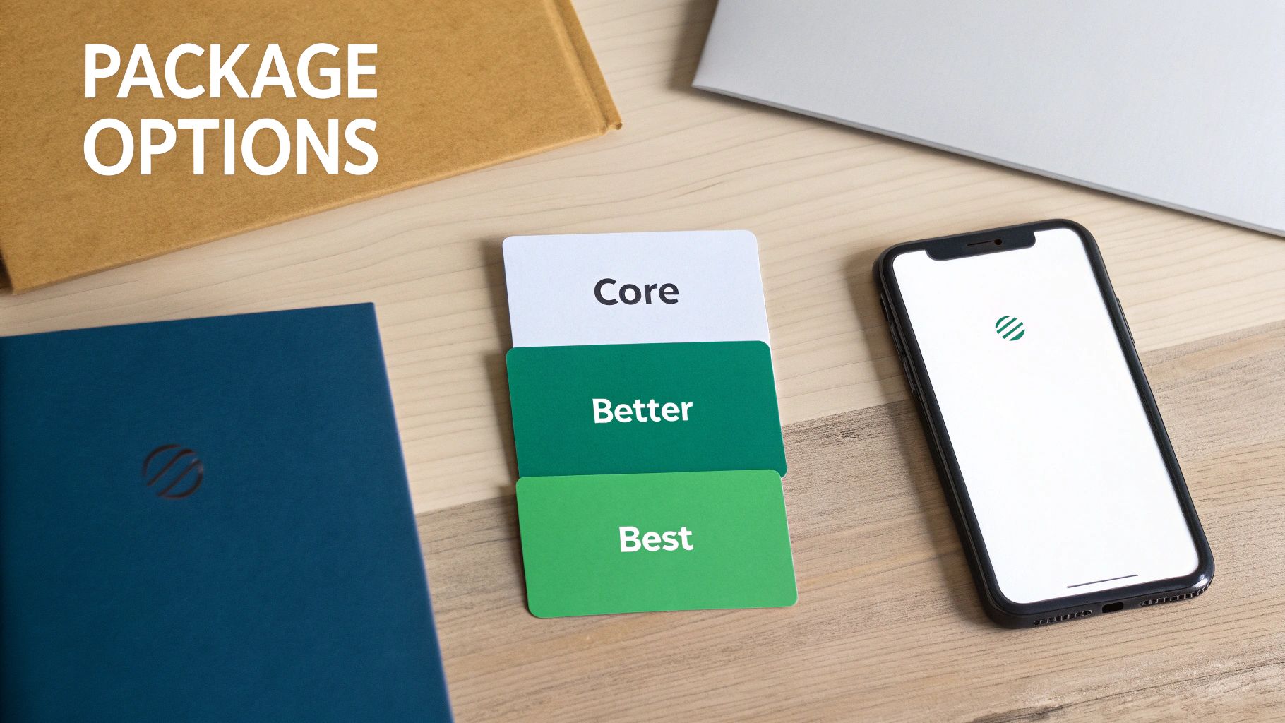
Building Tiered Packages: Good, Better, Best
A tiered package structure—often framed as 'Good, Better, Best'—is a seriously effective sales tool. It intuitively guides clients toward the best fit for their property’s needs and budget, simplifying their decision. This model empowers agents to match their marketing spend directly to the value and unique features of the listing.
Here’s a practical look at how these packages might break down:
Core Aerial Package (Good): This is your essential, entry-level option. It’s perfect for standard homes where the goal is to clearly show the property, its lot, and the immediate neighborhood. It's the workhorse package for the majority of listings.
- Includes: 10-15 high-resolution, professionally edited aerial photos.
- Ideal For: Standard residential properties under 3,000 sq. ft.
- Average Price: $250 - $450
Premium Listing Package (Better): This tier brings in video, which is a game-changer for creating an emotional connection with buyers. It’s designed for larger homes or properties with compelling features like a beautiful pool, unique landscaping, or killer views.
- Includes: Everything in the Core package, plus a 60-second cinematic video tour with licensed music.
- Ideal For: High-end homes, properties with unique features, or agents looking to elevate their brand.
- Average Price: $500 - $850
Luxury Estate Package (Best): The all-inclusive choice for luxury listings where telling a story is everything. This package combines multiple visual elements to create a comprehensive and immersive marketing asset that truly wows.
- Includes: Everything in the Premium package, plus twilight/dusk photos, digital property line overlays, and point-of-interest callouts (e.g., "Community Park," "Nearby Marina").
- Ideal For: Luxury estates, waterfront properties, and commercial real estate.
- Average Price: $900 - $1,800+
Essential Add-Ons That Boost Value
Beyond the standard tiers, offering à la carte add-ons gives agents the flexibility to customize their marketing even further. These are perfect for highlighting specific property features and can be tacked onto any package.
Here are a few popular add-ons that always deliver:
- Twilight Photography: Capturing a home during the "golden hour" creates a dramatic, high-end feel that makes a listing stand out from the crowd. This almost always requires a second visit to the property.
- Digital Property Line Overlays: Drawing property lines onto an aerial photo is incredibly helpful for showing the true size and boundaries of a large or oddly shaped lot. It takes the guesswork out for buyers.
- 360° Aerial Panoramas: An interactive panorama gives potential buyers a complete bird's-eye view. They can explore the property and its surroundings from every angle, right from their couch.
- Community Amenity Showcase: A quick video or a series of photos highlighting nearby parks, top-rated schools, and shopping centers can be a huge selling point, especially for buyers relocating to the area.
By offering a smart mix of well-defined packages and high-value add-ons, photographers can meet a wider range of client needs, while agents get to craft the perfect visual campaign for any property they list.
How Location and Property Type Influence Price
Not all properties are created equal, and neither are their photography needs. When you get a quote for drone photography, the final number is almost always shaped by two big things: where the property is and what kind of property it is. Getting a handle on these variables is crucial for agents who need to set realistic budgets and for photographers who want to price their work fairly.
Think of it like this: shooting a small, single-story home in a wide-open suburb is like driving on a straight, empty highway. It’s a pretty straightforward trip. But photographing a high-rise condo in a packed downtown core? That's more like navigating rush-hour city traffic—it takes a lot more planning, skill, and careful maneuvering around things you can't control. The complexity of the job sets the price.
The Geography Factor: Market Rates and Regulations
The biggest reason for price differences between cities is simply the local cost of living and business. A drone pilot based in Los Angeles or New York City has to charge more than someone in a small midwestern town because their own expenses—insurance, fuel, and just day-to-day costs—are way higher. As an example, a standard drone photo package in Los Angeles might run you about $318, while you could find a similar service in Phoenix for closer to $208.
But it’s not just about market economics. The specific location of a property can bring its own set of challenges that add to the cost. If a building is in a dense urban area or near an airport, it's almost certainly in controlled airspace. This means the pilot can't just show up and fly; they have to get official authorization from the FAA before the drone's wheels ever leave the ground. This process, known as LAANC (Low Altitude Authorization and Notification Capability), adds a layer of administrative work and requires a solid grasp of flight regulations.
An experienced pilot isn't just charging for their time in the air. They're charging for the expertise to navigate complex airspace legally and safely. That extra prep work for a shoot in a restricted zone is a billable skill that protects everyone involved.
Even properties way out in the country can end up costing more, but for a different reason: travel time. A photographer will almost always build in a travel fee if a listing is more than an hour or so from their home base, which is standard practice across the industry.
How Property Complexity Changes the Game
Once you get past the location, the property itself takes center stage. A standard 1,500-3,000 square foot house on a simple quarter-acre lot is the baseline for most photographers. Anything bigger, more complex, or more unique will require more time, more advanced flying techniques, and sometimes better equipment.
Here’s a quick breakdown of how different property types can push the price up:
Large Acreage and Ranches: You can't capture a sprawling ranch with just a few photos. It takes significantly more flight time and a well-planned strategy to show off the entire scope of the land. The pilot has to map out multiple flight paths, and the editing process often involves stitching together huge panoramas or adding digital property line overlays.
Waterfront or Luxury Estates: These high-end properties are all about the details—the intricate landscaping, the infinity pool, the boat dock, and those incredible views. A simple photo package just won't cut it. A cinematic video tour is pretty much expected, which dramatically increases the time spent both on-site and in the editing room.
Commercial Buildings: Shooting commercial real estate is a whole different ballgame. These buildings are often in busy areas, so the pilot has to plan the shoot carefully to work around pedestrian and vehicle traffic. For a deeper dive, you can learn more about the unique demands of commercial real estate photography in our detailed guide. This kind of work also tends to require more intensive post-production, like removing distracting objects or highlighting specific building features for marketing materials.
The Agent-Photographer Partnership: Your Secret Weapon
A stunning aerial portfolio isn't just about a fancy drone. It's the result of a solid, collaborative partnership between a real estate agent and a photographer. When both of you are on the same page and know what to expect, the whole process just clicks. The result? Better visuals, smoother shoots, and a long-term professional relationship that benefits everyone. This isn't just a transaction; it's a strategic alliance.
And in today's market, that alliance is more important than ever. The global Real Estate Drone Services Market was valued at USD 0.67 billion in 2026 and is expected to nearly double to USD 1.29 billion by 2030. That’s a huge indicator that aerial imaging is no longer a luxury—it’s a standard part of marketing a property. If you want to dig into the numbers, you can explore the full market research report. This explosive growth means more competition, making a reliable, go-to photographer a real competitive edge.
For Agents: How to Hire the Right Pilot
As an agent, your choice of a drone photographer directly reflects on your brand. It affects your listing's performance and, crucially, your legal standing. Taking the time to properly vet a pilot isn't just a good idea; it's non-negotiable.
Here’s a simple checklist to run through before you book anyone:
- Ask for the FAA Part 107 License: This is the first and most important question. Commercial drone work requires this certification. No license, no flight. Hiring an unlicensed pilot is illegal and opens up you, your brokerage, and the homeowner to a world of liability.
- Confirm They Have Liability Insurance: Accidents happen. A true professional will carry a liability policy of at least $1 million to protect everyone involved. Don’t just take their word for it—ask for a certificate of insurance (COI).
- Scrutinize Their Portfolio: Look for more than just pretty pictures. Is their work consistent? Does their editing style align with your brand? Pay close attention to their real estate work specifically. Do they know how to capture the angles that sell a home?
Once you've found your pro, a little prep work goes a long way. Give them a clear shot list with your must-have angles. Think about things like a direct overhead shot to show the lot size, a view highlighting the home's proximity to a park, or an angle that features a brand-new roof.
A great partnership thrives on communication. A five-minute conversation about the property’s key selling points before the shoot can make the difference between generic aerials and images that truly sell the home.
For Photographers: How to Be the Pro Agents Rely On
For drone photographers, building a business that lasts is about more than just your flying skills. It’s about professionalism, clear communication, and smart pricing. Your profitability starts with knowing your numbers. You have to factor in all your costs—your gear, insurance, software subscriptions, licensing fees, and, of course, your time for planning, shooting, and editing.
How you present yourself is just as critical. Ditch the quick, one-line price email. Instead, send a clean, branded quote that clearly outlines everything:
- What’s in the package (e.g., number of photos, video length).
- Any add-ons included (like property line overlays).
- The all-in final price and your payment terms.
- Your standard turnaround time for delivering the final files.
This kind of transparency builds immediate trust and shows you’re a serious business owner, not just a hobbyist with a drone.
Finally, curate a killer portfolio that screams "real estate expert." Organize it by property type—residential, luxury, commercial—so an agent can quickly see you have the specific experience they're looking for. A powerful portfolio, backed by fair pricing and professional communication, is your best tool for landing and keeping high-value real estate clients.
Common Questions About Drone Photography Pricing
When it comes to pricing for drone photography, a few questions pop up time and time again, both for real estate agents and for the photographers themselves. Getting straight answers is key to setting the right expectations and making sure the entire project runs smoothly.
Let's clear up some of the most common questions I hear.
How Much Should a Basic Aerial Photo Package Cost?
For a straightforward package of 5-10 professionally edited aerial photos for a typical single-family home, you should budget somewhere between $175 and $450.
Why the range? It really comes down to the photographer's experience, the quality of their gear, and what the going rate is in your specific market. A newer pilot might be closer to the $175 mark to build their portfolio, while a seasoned pro with top-tier editing skills will command a price closer to $450. Always ask what's included—things like travel fees and turnaround time should be crystal clear upfront.
A quick but crucial note: Hiring a pilot with an FAA Part 107 license isn't an optional upgrade. It's the law for any commercial drone flight in the U.S. This certification is your assurance that the pilot knows the rules of the sky and operates safely, which protects you, your client, and your brokerage from some serious legal headaches.
Why Is Hiring a Licensed Pilot So Important?
Think of the FAA Part 107 license as the minimum standard for any professional. It’s illegal to pay someone without this certification for real estate marketing photos.
A licensed pilot not only understands how to navigate complex airspace and handle safety protocols, but they also carry the right insurance. When you hire a professional, their rate already reflects the investment they've made in getting and maintaining this essential certification. It's peace of mind, built right into the price.
How Should I Price a Large or Complex Property?
This is where standard packages just don't cut it. If you're a photographer tasked with shooting a large estate, a commercial building, or a property stuck in tricky airspace, you need to create a custom quote.
Your best bet is to build the price from an hourly rate for your time on-site, plus a separate line item for any advanced post-production work. Don't forget to account for the extra pre-flight planning, the time it might take to get airspace authorization, and a proper risk assessment. Walking your client through these extra steps not only justifies the higher price but also highlights your professionalism.
Ready to find a top-tier, vetted real estate photographer in your area? On PropPhoto, agents can browse portfolios and book with total confidence. Photographers can build their business and keep 100% of their earnings. Find your next creative partner today.

